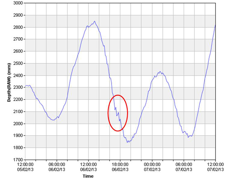
Last year a joint project between KIRMA (Kosrae Island Resource Management Authority), NIWA, SPREP and FSM PACC resulted in the installation of our first ever tide gauge in Lelu Harbor. The project was funded by GEF/UNDP. The tide data is collected every 10 minutes and transmitted to the various offices.
I thought that you might be interested in the following graphic of the sea water height in Lelu Harbor as the tsunami wave passed Kosrae. The red circle marks the point when the wave should have been passing Kosrae and it looks like there was about 2 inch increase in water height at that time.
My thanks to Doug Ramsey at NIWA for creating the graph and the folks at KIRMA and FSM PACC for allowing me to publish it.
Katrina


One Response to Solomon Island Tsunami Kosrae Tide Levels